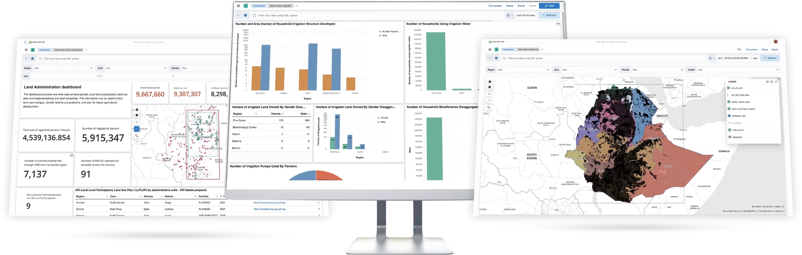
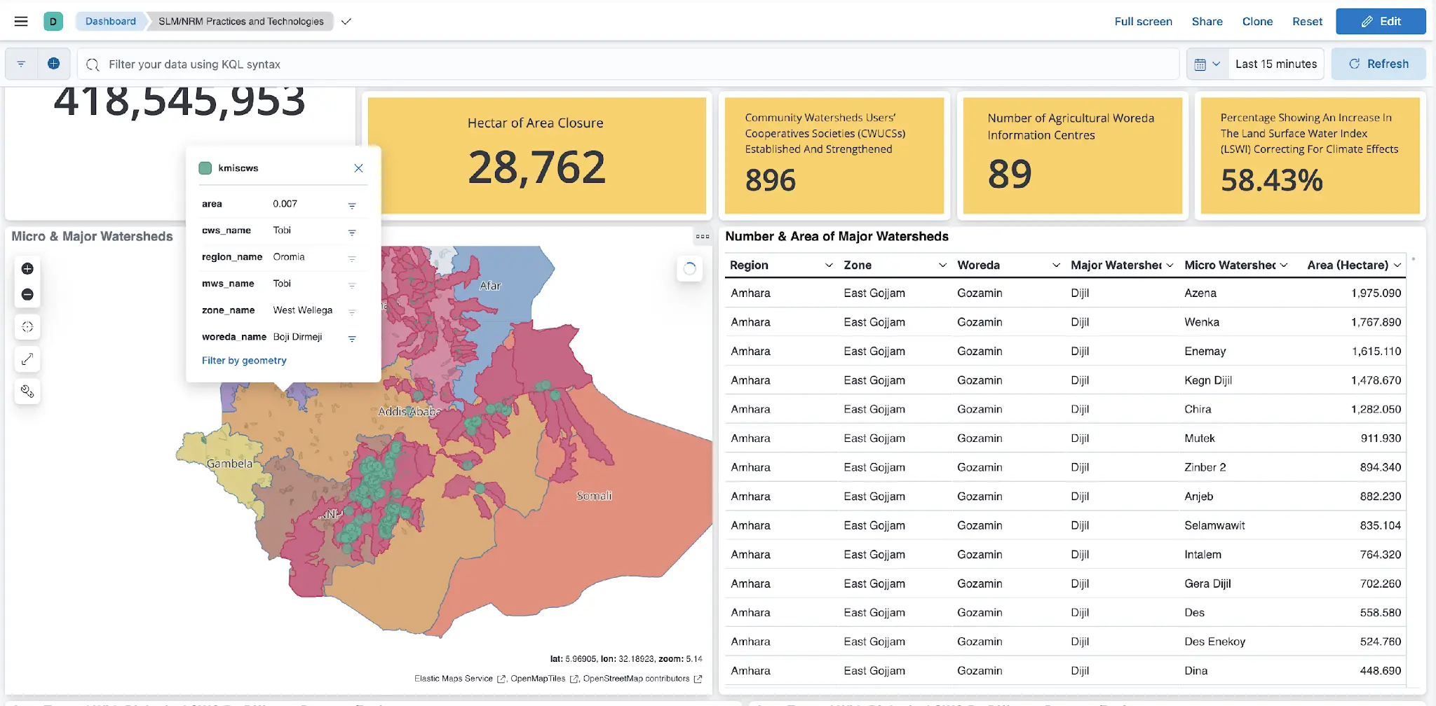
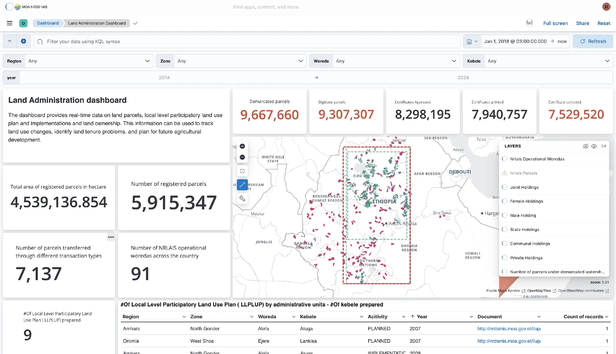
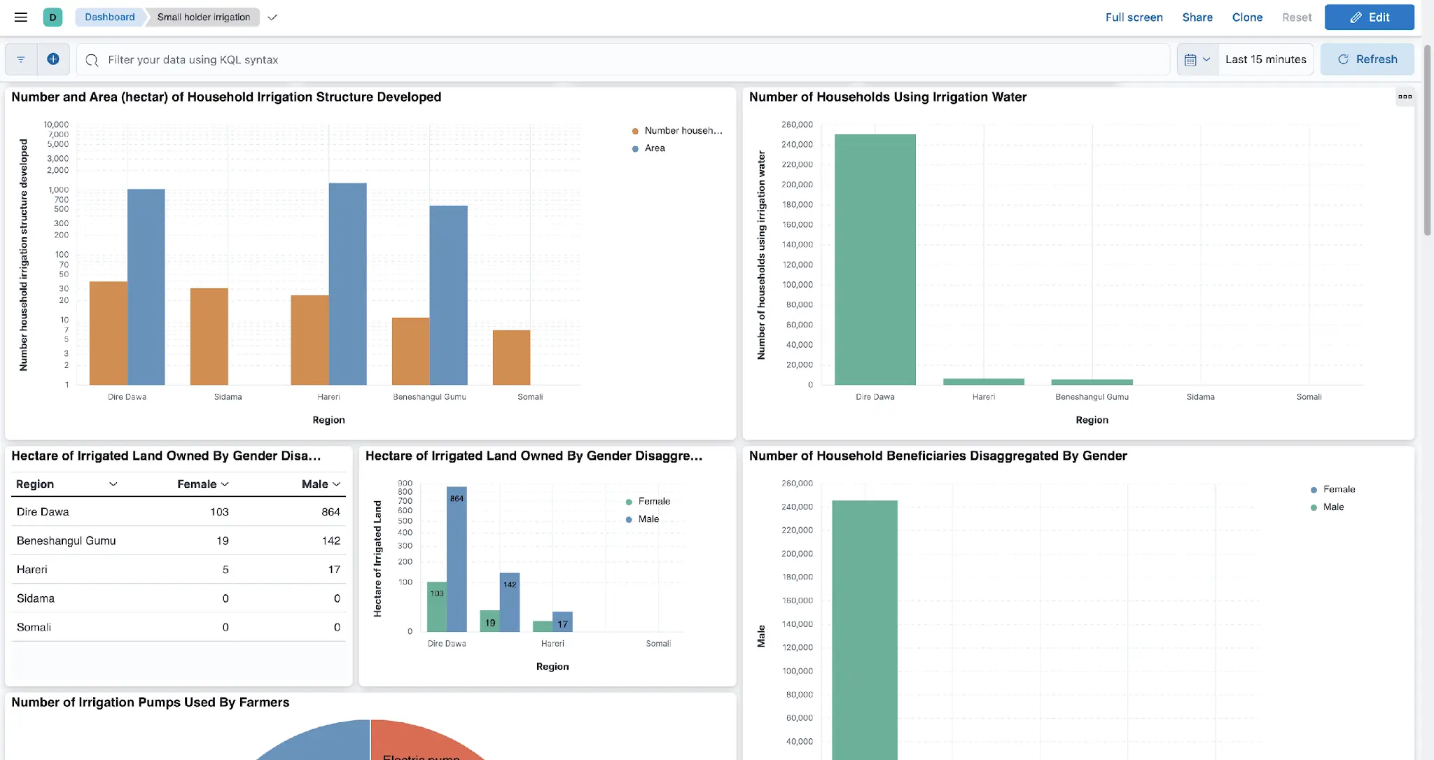
Siloed legacy systems, incompatible formats, and over 1TB of dispersed spatial data made it difficult for the Ministry of Agriculture to plan, allocate, and manage resources effectively. Data from land, irrigation, and soil systems remained fragmented and underutilized.
We developed the Integrated Natural Resource Management Information System (INR-MIS), a geospatially enabled portal that aggregates 14+ systems. Using OpenLayers, PostGIS, GeoServer, and custom APIs, we delivered map-based dashboards, spatial analytics, and multi-source integration—all within one platform.
Faster planning. Smarter decisions. A unified view of 400,000+ parcel records across Ethiopia. INR-MIS empowers the Ministry of Agriculture with real-time tools for land management, irrigation tracking, and green development—built on scalable, modern spatial infrastructure.
A centralized, geospatially-powered digital platform that aggregates, visualizes, and analyzes natural resource data from across the ministry’s departments and systems—providing decision-makers with the insights needed to plan, allocate, and manage resources effectively.
With data scattered across over 14 fragmented legacy systems, the Ministry of Agriculture faced significant barriers to integrating and analyzing key datasets related to land, irrigation, soil, and public works. These systems were siloed, often incompatible, and handled vast volumes of geospatial information—making cross-sectoral planning and real-time decision-making nearly impossible.
We designed robust ETL pipelines to ingest and harmonize data from over 14 systems—including NRLAIS, CALM-MIS, SLMP KMIS, NSIS, and more—into a centralized data lake, processing over 1TB of spatial and tabular data.
We implemented a scalable spatial stack using PostgreSQL/PostGIS, GeoServer, and OpenLayers. Custom APIs enabled geocoding, proximity analysis, route optimization, and thematic map visualization using Styled Layer Descriptors (SLDs).
We delivered intuitive, map-based dashboards that provide real-time insights and analytics. These tools empower planners and policymakers with access to actionable data for resource allocation and day-to-day natural resource management.
Every project is a journey, and we measure success by the results our clients achieve. From MVPs that disrupt industries to enterprise solutions that scale globally, these stories show how we transform ideas into market-leading solutions.